Surface and river water to impact campus
Low areas on campus and along the Red Cedar River
–
Flooding update
MAP.msu.edu is updated to show flood areas.
Update: April 20 at 8:30 am - river level is at 6.9' and is anticipated to be back in normal 6' on Tuesday. Power will be returned to Old College Field today. Additional rain is expected for Thursday through Saturday is not forecasted to be enough to bring us back to flood levels.
Update: April 19 at 3:30 pm - river is now at 7.5'. The flood warning expires on 4/21 at 2 am. Temperatures drop overnight which may cause some icy spots on sidewalks that still have water on them. Road detours are being removed and sidewalk detours are being adjusted.
Update: April 18 at 9:30 am - all bridges are flowing smoothly, except Hagadorn Road has a log job. City of East Lansing has been notified.
Update: April 18 at 8 am - water now expected to crest this morning.
Update: April 17 at 2:30 pm - flood level prediction changed to 8.5' and will adjust based on rainfall overnight.
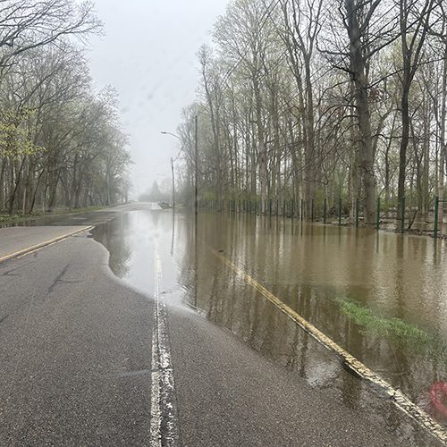
UPDATE: April 17 at 10:30 am - water level is increasing down Red Cedar Road toward Lot 124.
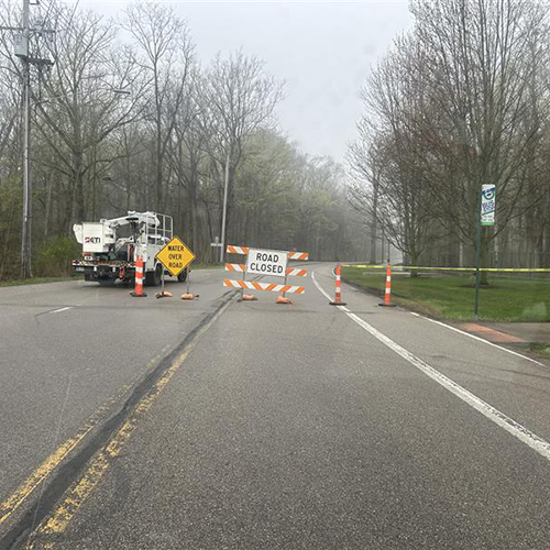
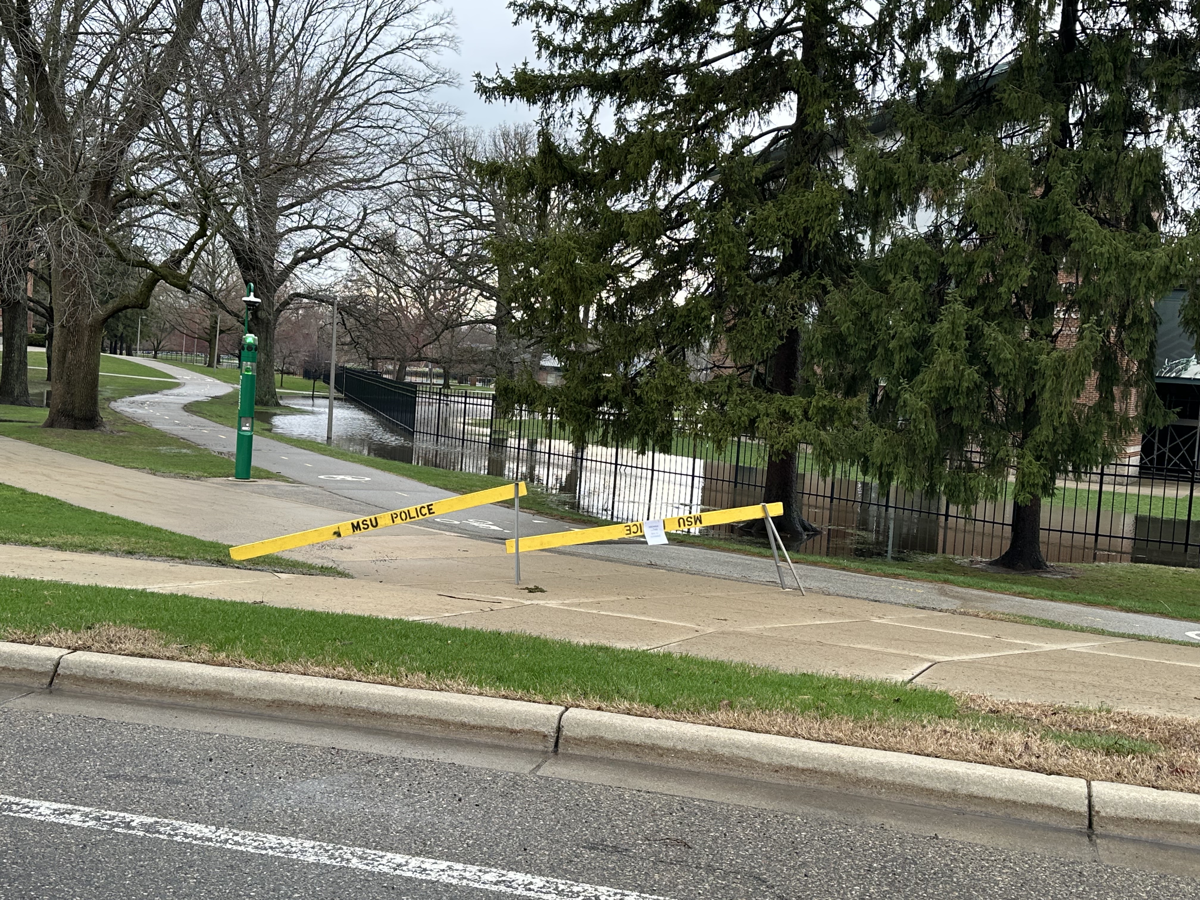
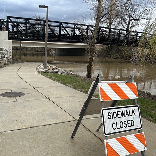
UPDATE: April 17 at 8:30 am - Red Cedar is closed now. Walks behind Jenison are closed as well as river trail north of Business College. Chestnut Road at Demonstration Hall Road toward the Sparty intersection is now closed. Lot 124 (also known as 62E) is being closed.
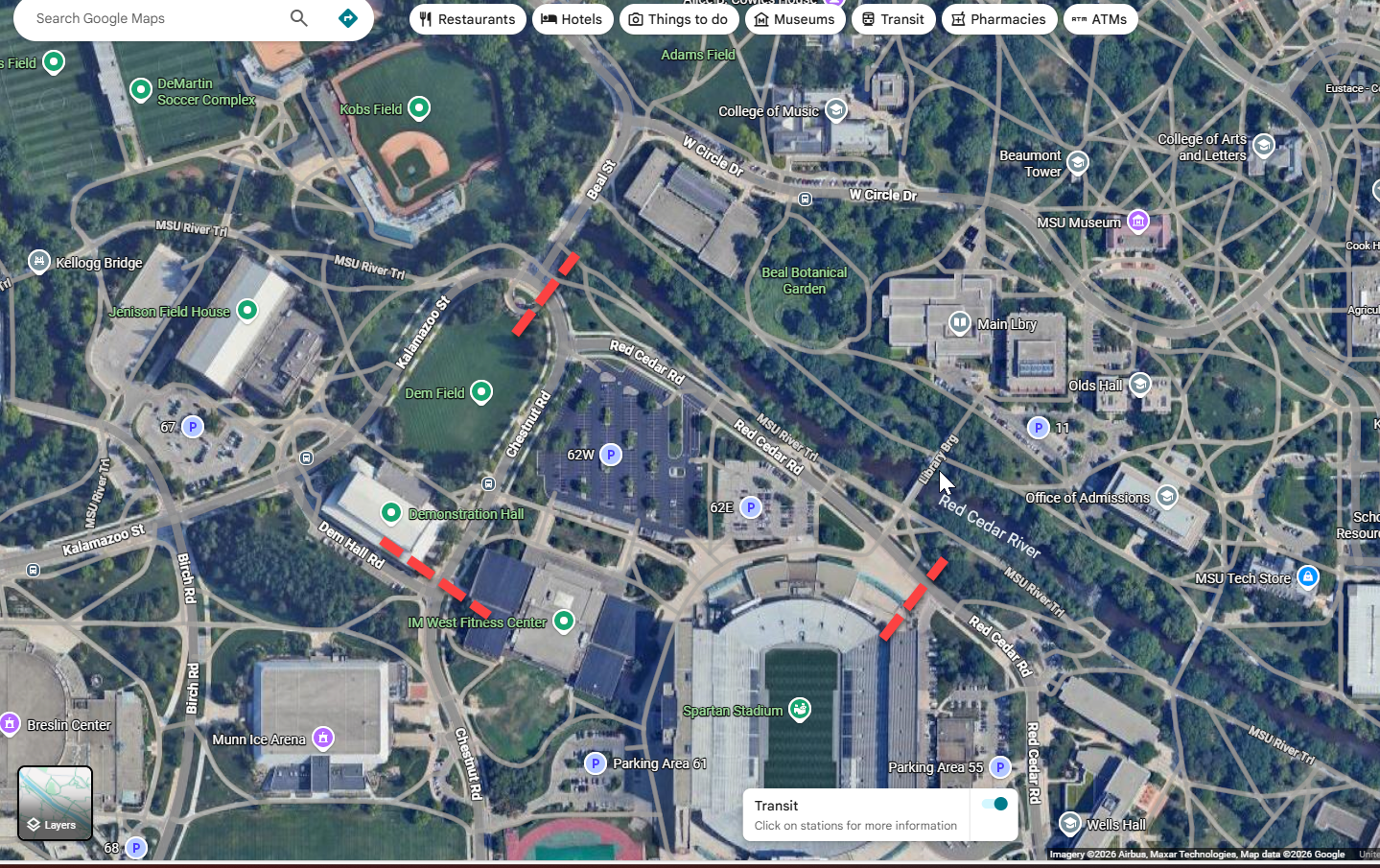
Map: Roads closed between the red dotted lines at Beal Street and Red Cedar Road, down Red Cedar Road to the Stadium. Road closed from Beal Street down Chestnut Road to Dem Hall Road.
UPDATE: April 17 at 1 am - water is at 7.5' and the crest has changed to 8.9' on Saturday at 8 pm instead of the afternoon as initially expected.
UPDATE: April 16 at 7 pm - The walks from Kellogg bridge to the corner by Sparty are blocked off. The back lot at Jenison (lot 67) is closed off. The walks from Beal garden to the Library (including the bridge) are blocked off. The walks on the north side from the Farm lane bridge to Bogue are blocked off, as well as the lower walks along the river behind the Business College. The lower parking lot at the Community Music School is blocked off and the duck feeding area still has the stand alone fence panels blocking it off. Landscape Services team members will be back in at 2am and will check everything again.
UPDATE: another flood expected over the next seven days, starting April 17.
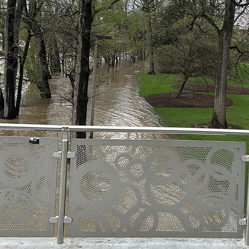
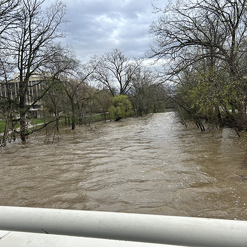
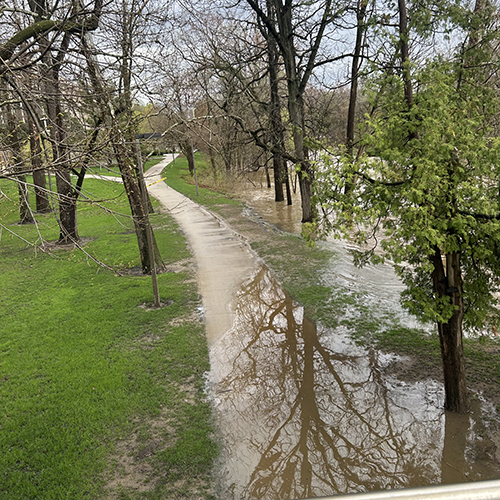
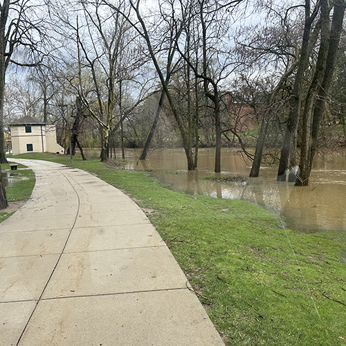
The Red Cedar River in East Lansing is predicted to crest at 8.7’ (Minor Flood Stage) per the National Oceanic Atmospheric Administration (NOAA) after the recent rainfall and snow melt.
Campus roadways and parking lots may be impacted by flooding. Pedestrian and bike pathways along the river will be partially closed Saturday and over the following week. Barricades will be left up until the water has receded. The peak is predicted on Monday afternoon. Weather forecasts predict additional rainfall early next week, so please continue to monitor the weather and follow our recommendations outlined below.
The following areas on campus (map) are expected to be affected and will be temporarily closed:
Sidewalks
- Along the river between the Alumni Memorial Chapel and the Farm Lane bridge.
- Sidewalks along the river in Beal Botanical Garden
- Between the Kellogg Center and The Sparty Statue
- The Kellogg footbridge from the northeast corner of Kellogg Ramp 4
- From Lot 67 (Jenison) along the south side of Old College Field to the Sparty Intersection (Beal Street, Chestnut Road, and Kalamazoo Street)
- Along the south bank from Lot 67 (Jenison) to the library bridge and from Farm Lane bridge to Bogue Street bridge.
- Along the north bank from Beal Street bridge to Bogue Street Bridge.
- From Farm Lane bridge to the Bogue Street bridge along north bank
- From Bogue Street bridge to Shaw Hall behind Business College along south bank.
- From IM Circle to Library bridge throughout Beal Garden
- From the administration bridge to MSU Bike Shop near Bessey Ramp and pump station.
Roadways
- Red Cedar Road from Lot 124 bus stop through Lot 62 and Chestnut Road.
- Kalamazoo Street entrance to campus will likely be closed by the City of East Lansing
Parking Lots / Ramps
- Lot 83 on Service Road
- Lot 61 on Chestnut Road
- Lots 62 north of the Stadium on Red Cedar Road
- Lot 67 Parking areas at Jenison on Kalamazoo Street
- Lot 67 to the drive lane for Kellogg Ramp
- Lot 106 behind the MSU Community Music School on Hagadorn Road
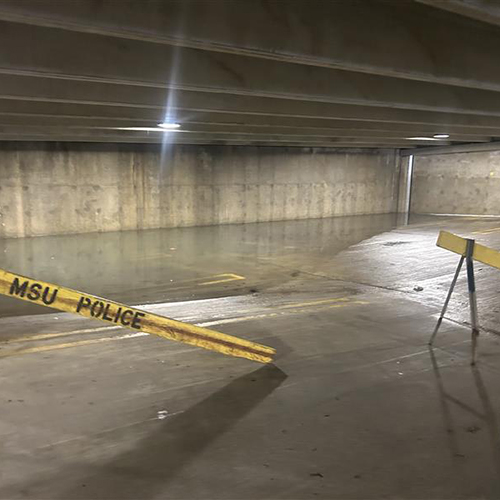
- Bessey Hall Ramp 2 lower level
Fields / Grounds / Gardens / Patios
- Beal Gardens
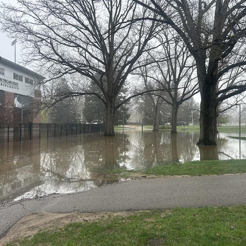
- Demonstration Hall Field behind Sparty
- Kresge Art south patio steps
- MSU Bike Shop southwest corner
- Duck Pond area including the steps behind Wells Hall
Buildings
- Near active construction sites
- Old College Field sports complex
- Human Ecology lower level
- Kellogg Center basement
Infrastructure Planning and Facilities along with MSU Department of Police and Public Safety will be watching rainfall and on-site conditions frequently to ensure campus safety.
Close windows to prevent water from entering the building. This is especially important on lower levels which may experience rainwater splashing back onto the building windows.
Do not attempt to travel on walkways, roads, lots or ramps that are closed. The water depth and speed over surfaces may be deceptive.
Look for water intrusion in buildings and report occurrences immediately to ContactIPF (517) 353-1760.
View the campus map for flood level impacts.
Access this page through the MSU Safe App using the Flooding Updates icon.
Roadways, sidewalks, parking lots and all other public spaces will continue to be monitored by IPF crews throughout the duration of this storm event
Students living on campus should report building issues to Residence Education and Housing Services as normal.
Other building or campus issues should be reported to IPF by calling (517) 353-1760. Report any emergencies by calling 911.
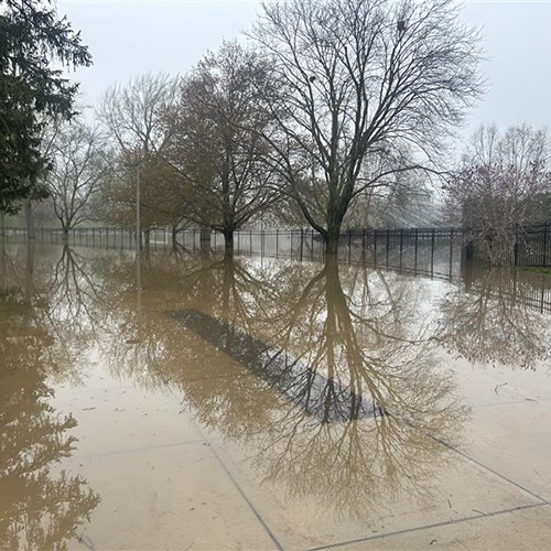
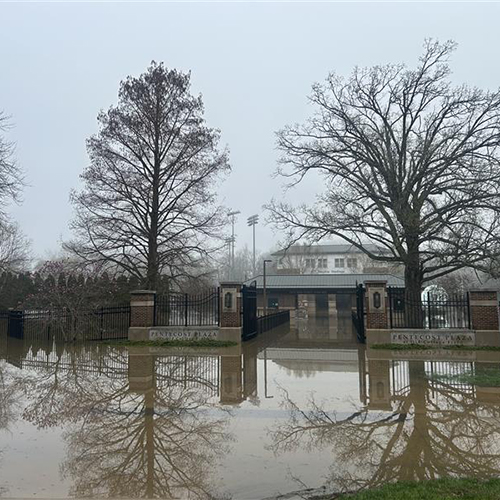
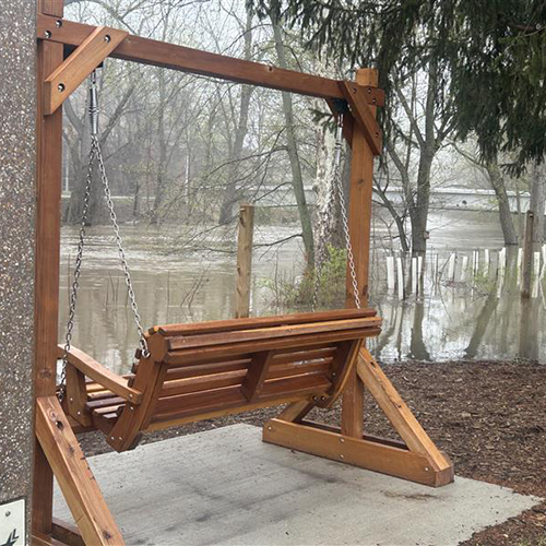
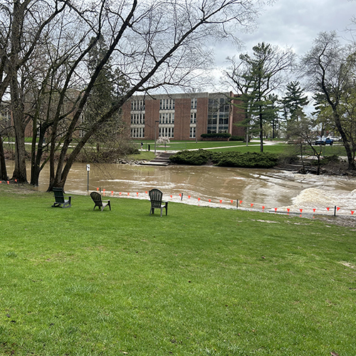
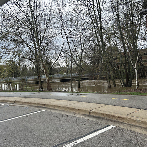
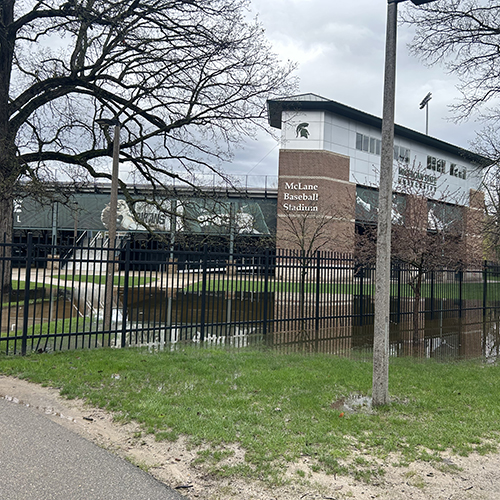
April 17 Images Gallery
8 am
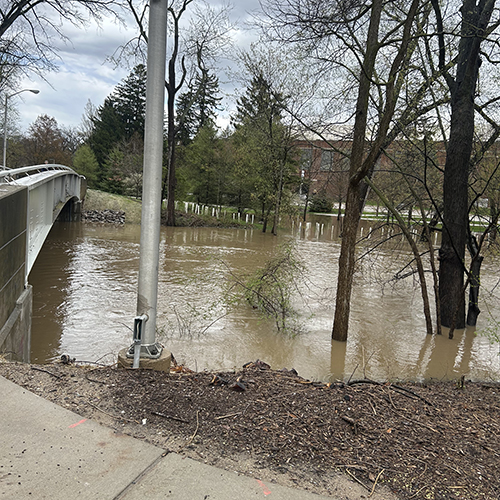
10:30 am